

Trips and excursions in Paneveggio
Our hotel La Bicocca is in a perfect position for trips and excursions in Paneveggio. It is located in the middle of a nature park and just a few steps away from the fenced-in area where the deer live.
Our guides always plan trips and excursions inside the park to accompany guests who prefer to rely on us and not walk along the paths on their own. Below you can discover some of the most beautiful excursions to take during your holiday.
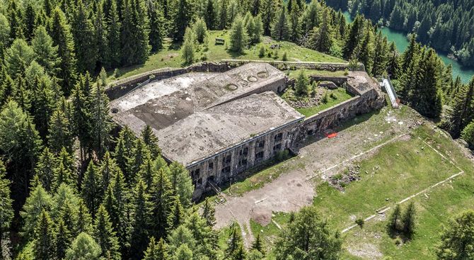
Dossaccio Fort
Slide title
Scrivi qui la tua didascaliaButton
- Departure times and differences in altitude
The route starts near the Paneveggio Visitor Centre at 1,500 metres of altitude. A little further down, a few hundred metres, near the bridge over the state road, where the Val dei Buoi begins, are the signs for the fort. The route follows a forest road and, in the last section, a military mule track. The route is completely signposted. After an hour you reach the fort at 1,838 metres. The difference in altitude is around 350 metres.
- Path
The " Terra Foresta" Visitor Centre in Paneveggio tells the story of the majestic national forest. A vast strip of forest extends for about 2,700 hectares and fans out over the high basin of the Travignolo, between the Lagorai chain, the Pale di San Martino and the Cima Bocche mountain group, at an altitude ranging from 1,400 to 2,150 metres. The Park Visitor Centre is located in the renovated rooms of a former Venetian-style sawmill. The displays tell the secrets of the soil and subsoil of the great forest. Visitors can thus discover the richness and biodiversity hidden in that space that is normally not observed but trodden on: the humus and the first layers of soil. Leaving the village of Paneveggio, the trail follows the forest road. After about a kilometre, you come to a large clearing called "Carigole", frequented by deer and roe deer. From here, you continue through extensive spruce woods, some of which are centuries old and can reach a height of 40 metres. The last stretch is along a military mule track. When you reach the fort, an extraordinary panorama opens up over the peaks of the Lagorai Group and the Pale di San Martino.
Malga Bocche
Slide title
Scrivi qui la tua didascaliaButton
- Departure
It starts from Paneveggio, where there is a large car park next to the Visitor Centre, which can also be reached using the shuttles departing from Val di Fiemme and Valle di Primiero (for timetables see the brochure "Il Parco in Tasca" or the pocket card, also available on the Park website www.parcopa.org). Summer opening hours of the centre 9–12.30 am and 2–5.30 pm. Telephone number +39 0462/576283.
- Times and differences in altitude
The route is circular. The walking time is 1 hour and 30 minutes on the outward journey. On the way back you can estimate the same duration because the path is wider. It starts from Paneveggio (1524 m) and reaches Malga Bocche (1946 m), the difference in altitude is about 400 metres.
- Path
The route starts from Paneveggio, next to the canteen of the Forestry Authority, located about a hundred metres uphill from the Forestry Station. The first part coincides with the Val Miniera route. Along this route, there are precise indications at every fork. The trail crosses the extraordinary setting of the big Paneveggio forest. Here, spruces make up almost 90 % of the trees in the forest. Centuries-old spruce trees, which can reach a height of 40 metres, still survive among them. After about 30 minutes along this path, the trail leads to a forest road, which continues for about 15 minutes. The route then leads onto a mule track, partly paved, dating back to the First World War. After about 45 minutes, the path reaches the pastures; here, before leaving the mule-track, it is possible to enjoy a suggestive view of the Rio Bocche, which creates extraordinary gorges along its descent. From the Malga, you can enjoy the unique sight of the junction between the Pale di San Martino and the Lagorai mountain range. For the return journey from the Malga, you can slightly change the route along path no. 626 CAI, which starts right in front of the Malga, towards the valley. After 20 minutes along this path, you will reach the flat forestry road that, after just over an hour, leads back to Paneveggio, next to the Forestry Station. At the "Terra Foresta" Visitors' Centre in Paneveggio, you can find out about the spruce forest of the same name, known to all as the Violin Forest because of the quality of its resonance environments used by violin makers of all times. This year, the Visitor Centre holds an exhibition dedicated to the butterflies present in the Park. The species of Papilionoidea recorded in the last two years include 91 species, several of which are particularly rare and of community interest.
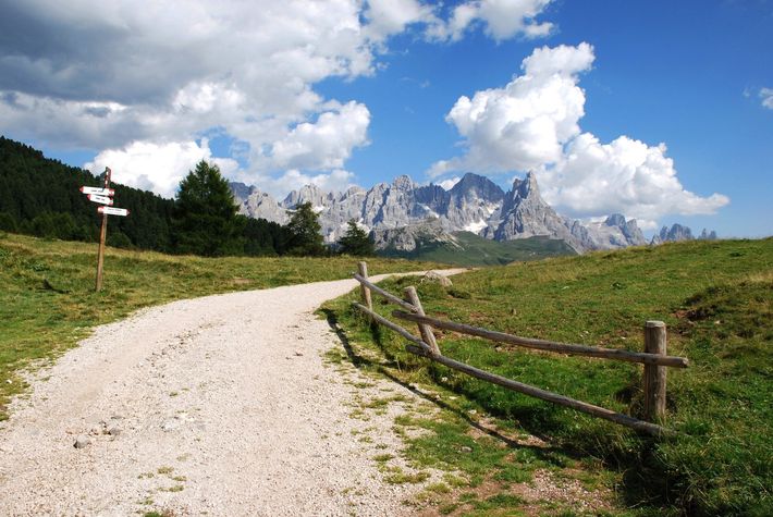
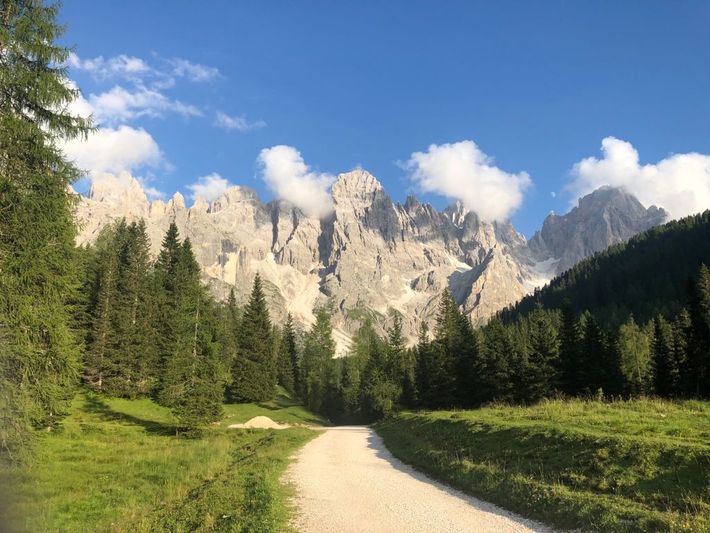
Val Venegia
Slide title
Scrivi qui la tua didascaliaButton
- Where it is
The route starts near the Paneveggio Visitor Centre at 1,500 metres altitude. A little further down, a few hundred metres, near the bridge over the state road, where the Val dei Buoi begins, are the signs for the fort. Take a forest road and, in the last section, a military mule track. The route is completely signposted. After an hour, you reach the fort at 1,838 metres. The difference in altitude is about 350 metres.
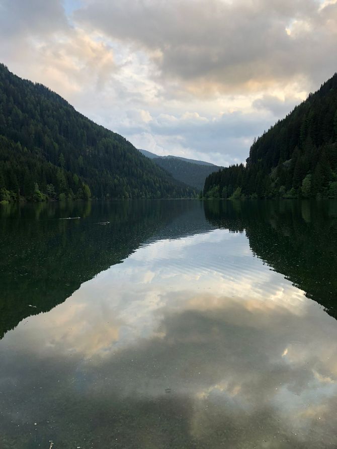
Geological Trail Calaita- Cima D'Arzon
Slide title
Scrivi qui la tua didascaliaButton
- Departure
You can start from the car parks near Lake Calaita or, in summer, you can use the Park shuttles from Vanoi and Valle di Primiero.
- Times and differences in altitude
This, too, is a circular excursion that starts from Lake Calaita (1,621 m) and reaches Lake Pisorno (2,227 m), the locality of Lake Giarine (2,125 m) and Malga Grugola (1,783 m).
The walking time is four and a half hours, with a total difference in altitude of 600 metres.
- Path
After leaving the parking area and passing an initial short stretch of forest road (signposted "Malga Grugola"), take the SAT E347 path on the right, signposted "Lago Pisorno".
Climbing up the glacial step, you pass an avalanche channel (Boal de la Lasta Moia).
A second short glacial step leads to the Busa de Mèz peat bog and a small lake. Here the arboreal vegetation ends due to altitude limits, and you walk over open pastureland.
Once passed the peat bog and the Smandrizòt area, the trail joins the path that leads to the right, with a quarter-hour detour, to Lake Pisorno, and on the left, on the SAT E347 bis path, to the watershed ridge between the Pisorno and Grugola valleys.
This one is an exceptional panoramic spot, with a great view of the Pala Dolomites group, the Feltrine\Sass de Mura mountains, and the Catinaccio mountain group.
From here, with a short detour uphill, in about 15 minutes, you can reach the meadowy Cima Grugola, where you can enjoy a spectacular view also looking northwards, over the Lagorai mountain range and the Austrian mountains.
From this spot, the path crosses the slope in a southerly direction until it reaches Forcella Folga and the SAT E358 path. From Forcella Folga, the trail goes downhill through the Valle di Grugola, remaining on the existing path. The last stretch of the route cuts across the Grugola forest road to reach the bridge over the Rio Grugola and then to the signpost at the Campigolo del Rosso biotope/peat bog. A further short stretch of forest road leads back to the starting point.
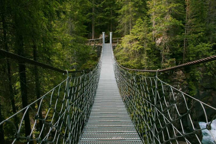
The suspension bridge along the Marció path
Slide title
Scrivi qui la tua didascaliaButton
This is one of the most exciting excursions and hikes in Paneveggio, even if it does not lead to breathtaking views.
- Where is it
Start from the car park behind the Terra Foresta Visitors' Centre in Paneveggio (1,524 m), which is about 15 minutes from Passo Rolle.
- Path
The itinerary develops inside the Paneveggio forest, known as the " Forest of the Violins" for its precious spruces used to build the soundboxes of high-quality violins.
It is a circular route, suitable for everyone because the difference in altitude is only 20 metres and, in about 60 minutes, you will be back at the starting point.
From the car park, take the forest road and follow the signs for the Marciò path. Shortly afterwards, cross a magnificent covered bridge over the Travignolo, from where you can see the torrent rushing by under your feet through the glass panels in the pavement.
The path then continues into the forest, where information boards have been placed, aimed mainly at children, who will have fun guessing the animal to which the various footprints belong.
Almost at the end of the path, the trail crosses a bridge suspended over a gorge crossed by the Travignolo, a rushing torrent that forms beautiful rapids and waterfalls in the gorge. The bridge doesn't swing much, so it can be crossed even by those who are a bit scared, and the crossing is very short.
From the bridge to the car park is a short distance. If you are only interested in the bridge, you can take the path in the direction opposite to the one suggested, and you will arrive in just a few minutes walk.
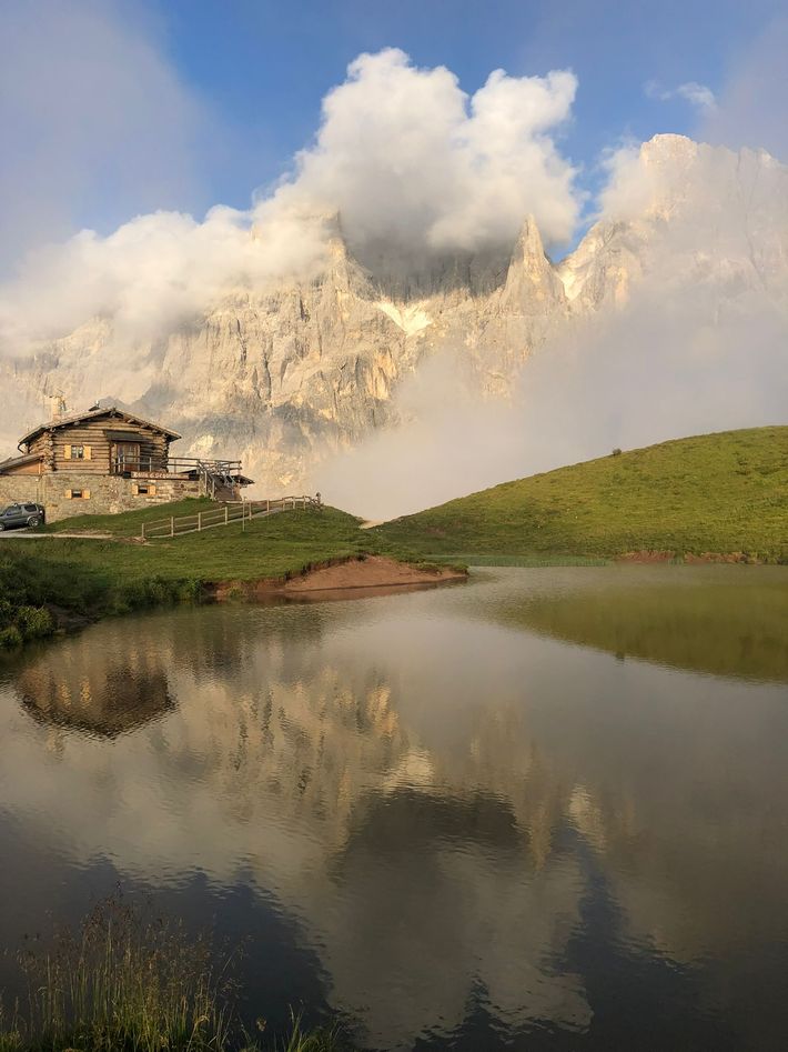
Baita Segantini
Slide title
Scrivi qui la tua didascaliaButton


